

Silent and Invisible - Revolution from the Skies
Silent and Invisible - Revolution from the Skies


When was the last time you opened a physical city map or a road atlas? I am assuming you opened one, depending on your age. I don’t blame you if you can’t recollect. I have been trying to answer this question: was it in Istanbul in 2007? or Jordan in 2010? But as a ballpark, I have not touched a road atlas in close to fifteen years. Now let me ask another question? What would be the impact on your daily life today if GPS were not available? Well, you will not be the only one to roll your eyes! I use Global Positioning System (GPS) driven Location Based Services (LBS) for driving, my morning runs and fitness apps, Google maps, ordering food, Uber and Ola on a regular basis and few others based on the need. I cannot imagine my life today without those conveniences that I take for granted.
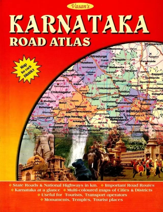
But life was not always like this. I am 53, born in 1970. For the first forty years of my life, none of these services existed and many of us in our imagination would not have anticipated them and we were blissfully ignorant about GPS. During the 1990’s at the peak of my biking experience, when we would take-off to explore various parts of Karnataka from Bangalore, our GPS system looked something like this 😊
It was an indispensable guide and I always had one in my rucksack. While these maps provided broad directions, we had to know our orientation: North, South, East and West and we asked people for directions every now and then. We navigated in cities and between cities and towns based on landmarks: a temple here, restaurant, popular junction, showrooms, govt offices, monuments, museums, you name it, and everything had a useful role in getting us to the destination. We had a gyroscope built into us, which took us to our desired destinations, but also got us home eventually. We knew the terrain and topography well and had developed a well-honed intuition. Yes, we still got lost, my most scary and funny experience being lost in the middle of a jungle in South Karnataka, in middle of the night and low on fuel.
It is amazing to look back and see how much and how fast things have changed, where life fifteen years ago feels like stone age. I had written about exponential change and how it blindsides us here. Lot of change that we experience is visible and can be felt as it happens, but something like GPS has taken us over in stealth, gradual and invisible.
When did this start?
GPS, like internet originated from the needs of the military and was a child of the 1960’s space race.
In 1957, Russia launched Sputnik, the first satellite to successfully orbit the Earth. As Sputnik orbited the planet, the satellite emitted a radio signal. A group of scientists in the Applied Physics Laboratory at Johns Hopkins University observed a strange phenomenon: The frequency of radio signals transmitted by Sputnik increased as the satellite approached, and the signal frequency decreased as it moved away. This shift is known in physics as the Doppler Effect. Utilizing the Sputnik’s Doppler Effect allowed the scientists to use radio signals to track the movement of the satellite from the ground. They later expanded the idea: If a satellite location could be determined from the ground via the frequency shift of its radio signal, then the location of a receiver on the ground could be determined by its distance from a satellite.
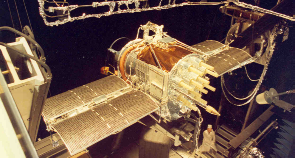
In 1958, the Advanced Research Projects Agency (ARPA) used this principle to develop Transit, the world's first global satellite navigation system. The first satellite for Transit was launched in 1960 and was capable of providing navigation to military and commercial users, including the Navy’s missile submarines. The program was transitioned to the Navy in the mid-1960s and by 1968 a constellation of 36 satellites were fully operational. Transit’s technology delivered accuracy to tens of meters, but in 1967, the Americans conducted an important experiment to test the reliability of atomic clocks in space. Its success paved the way for the creation of next-generation navigation devices capable of providing much greater positioning accuracy. The project under the aegis of DARPA was named Navstar, which later came to be known as GPS. The first satellite of the system was launched in 1978, with three more satellites launched by the end of 1978. More than 700 tests were conducted between 1977 and 1979 by the engineers in perfecting and confirming the accuracy of the integrated space/control/user system. The eventual GPS constellation had 24 satellites, which used atomic clocks at medium Earth orbits to provide a 12-hour period tracking.
But it took a terrible tragedy before this technology was opened up for commercial use.
In September 1983, Korean Air Lines Flight 007 was on its way to Seoul from New York City via Anchorage. Owing to a navigational mistake by the pilots, the airliner drifted from its original planned route and flew through Soviet prohibited airspace. It was shot down by a Soviet Sukhoi Su-15 interceptor. The Soviets treated the unidentified aircraft as an intruding US spy plane and destroyed it with air-to-air missiles. The plane crashed into the Sea of Japan, near Sakhalin island killing all 269 onboard.
As a result of the incident, the United States altered tracking procedures for aircraft departing from Alaska. In 1983, President Ronald Reagan authorized the use of Navstar for civilian commercial airlines in an attempt to improve navigation and safety for air travel and this move to provide free access to GPS data to industries outside the US military became the first step towards wide spread civilian usage. By 1989, commercially available hand-held GPS units hit the market, including the Magellan Corporation’s Magellan NAV 1000.
GPS technology continued to improve through the 1980s and 1990s, but there were growing concerns about adversaries using the GPS system and information against US interests. In response, the defence department decided to adjust the system for civilian use and introduced “Selective Availability”, which provided accuracy up to 100 meters. After the fall of Soviet Union and the end of cold war in 1991, things changed. In the 1990’s European countries realised the potential of a GPS like system and started efforts to develop their own versions for civilian use. Realising the threats this posed to the US ability to stay at the forefront of technology and innovation and to utilize the vast potential of a burgeoning industry, in May 2000, President Clinton authorized the removal of selective availability feature. This gave billions of people all over the world access to precise GPS positioning developed by DARPA,
The rest as they say is history!
How our lives changed
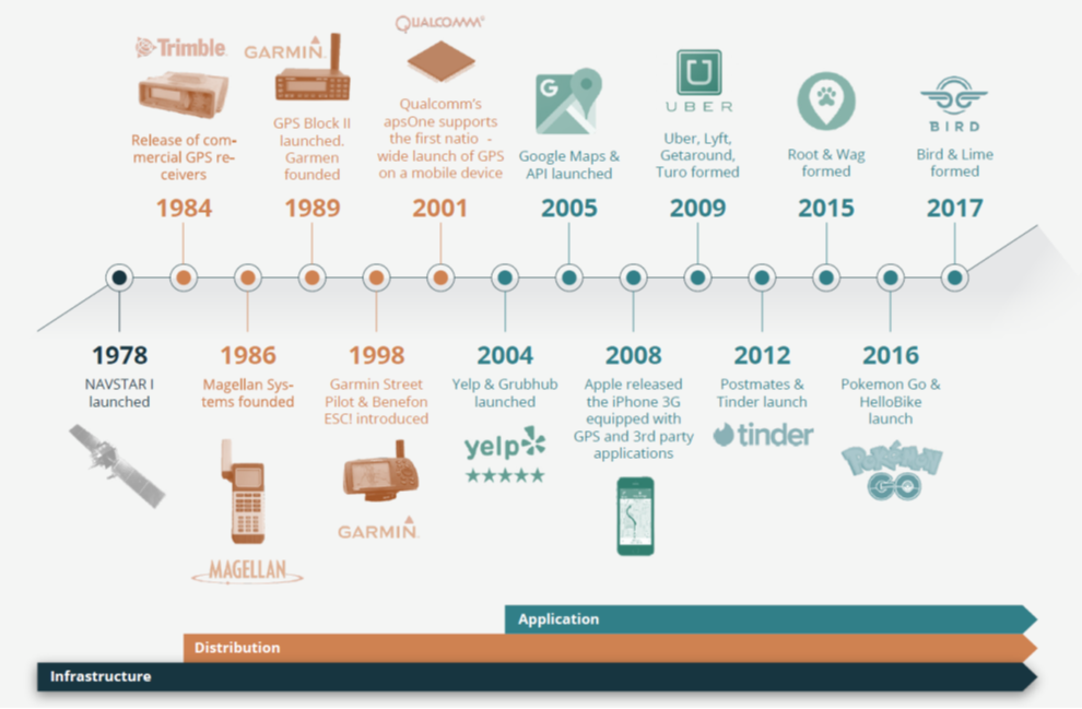
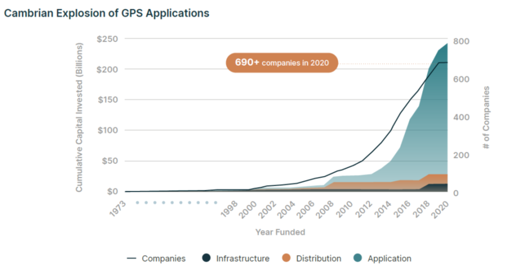
According to Space Capital, “Companies focused on the distribution of the Global Positioning System (GPS) laid the foundation for 82 companies to be founded between 1978 and 1999 and raising over $29 billion in equity financing and creating early application layers that moved GPS into the mainstream”. But it was Clinton’s decision in 2000 that was a game changer. GPS signals instantly became 10 times more accurate for civilians overnight. The price of GPS receiver and processing chips also dropped from roughly $3000 to $1.50. The increase in accuracy coupled with the decrease in cost led to exponential growth in GPS usage for in-car navigation, location-based services, personal technology, and usage in shipping, sailing and other industries. In June 2019, a report commissioned by the United States Commerce Department estimated that GPS has created $1.4 trillion of economic benefits in the US alone since the system became available for commercial civilian use in the 1980s.
Here is a brief timeline of GPS evolution, created by Space Capital.
Our day to day lives really changed when we started having phones with built-in GPS. I came across an old news article from Reuters, dated 16th October 2007, which said:
· “Mobile phone maker Samsung Electronics Co Ltd said on Tuesday it would launch its first-ever phone incorporating a Global Positioning System (GPS). The phone, called the i550 will use the operating software of Symbian and be available in Europe from November this year.”
Ah! You see, I was still using Istanbul city map in 2007 😊 Nokia, the worlds leading phone maker at the time followed suit and launched multiple models with GPS built in.
Quoting Space Capital again,
· “Perhaps the most important development of the decade came in 2008, when Apple released the iPhone 3G. Unlike its predecessor, the iPhone 3G came equipped with 3G, GPS, and 3rd party applications. This bevy of features was significant because they provided developers with a method of distribution for location-based applications and provided consumers with a powerful, beautiful platform through which they could experience them. Moreover, the iPhone was actually a camera, iPod, and cell phone in one device. This meant that new location-based applications that incorporated elements of these features could be developed.”
The availability of GPS on smartphones essentially created a distribution revolution. Now developers building apps using LBS could reach hundreds of millions of users through app stores and similar platforms.
GPS based applications and LBS have become critical not only for us, but also for our economic functioning. Here is a list of activities that depend directly on them:
· Navigation, mapping, location tracking and safety apps
· Check-in, and reviews apps
· Banking apps
· eCommerce, transport tracking and travel apps
· Ride hailing, shipping and delivery apps
· Weather apps
· Dating apps, social networks, and messengers
· Fitness and healthcare apps
· Local services, hospitality, and food delivery apps
· Gaming
The total number of GPS-enabled devices in operation is expected to grow to 9.6 billion in 2029 with Asia-Pacific accounting for more than half of the global market. With advances in GPS technology, leveraging improved receiver performance and miniaturization, a variety of new devices are hitting the market, building newer solutions and services. Drones are emerging as the next frontier after consumer and automotive applications. In the past few years, annual shipments of drones have grown multi-fold, and this growth is expected to continue into the next decade.
Final Words
This was an accidental article and 36 hours before I published it, I had no idea about writing this. I had originally lined-up another one, but as part of my research into “Space Economy”, which again I was planning to write after a few weeks, I had this epiphany about how GPS fundamentally changed our lives. I could not stop myself from writing about it and this is the most impromptu article I have written so far.
Coming back to my deep dive into Space Economy, what picked my interest a few months ago was the launch of Chandrayaan-3 by India. In the aftermath, the stocks of companies associated with the mission followed it into the orbit. I was sceptical to start with, but when I started understanding what was happening with Space, I was amazed at the extent of the ecosystem and the depth of work. While SpaceX tends to grab the headlines, the number of companies and people innovating, and the potential outcomes is mindboggling. GPS has been an early manifestation, but we are yet to see the real action. I hope to write in detail about “Space Economy – The Final Frontier”, but the way to understand the possibilities that Space offers was aptly put by Space Capital:
· “The history of GPS provides us with a framework for understanding how space-based technology has become a platform for innovation on a global scale. Specifically, the development of technology layers on top of space-based infrastructure and the distribution of data for mass adoption, which unlocks thousands of unique applications”.